British Orienteering publishes new habitat assessment report on the Land at Finsthwaite and Rusland Heights, Windermere Lake
13 June 2024
In 2023, British Orienteering commissioned a survey to understand the ecological impact an orienteering event could have on vegetation and ground compaction.
Here, we outline the key outcomes of the survey and recommendations that planners and organisers may find beneficial when planning future events. We thank the event planners and landowners for their assistance in enabling this important work.
This report has been prepared on behalf of British Orienteering, in relation to a ‘Check Point Orienteering’ event completed by approximately 2400 participants on the 8th of April 2023, at land to the west of Windermere Lake, incorporating Finsthwaite and Rusland Heights. We provided a general orienteering plan, which was based on participants finding check points without a pre-defined route.
The assessment of effects upon habitats from the orienteering event was completed by principal ecologist Miranda Cowan Ltd (BSc (Hons), PGCert FdSc, FISC grade 4, MCIEEM). Miranda Cowan has 22 years consultancy experience, having worked across a range of upland and lowland habitats (lower and higher plants) throughout the UK and Channel Islands.
Outcomes
- The field survey concluded the orienteering event to not have any significant impacts upon vegetation throughout the land extents shown as Figure 1. Only two areas of trampling external to Yewbarrow Woodland SAC and SSSI were identified, which reflected recovery from new vegetative growth. The survey visits completed in April 2024 confirmed evidence of purple moor-grass growth, which is a species that typically occurred in the low-lying bog area. Most importantly, there was no evidence of newly established desire lines that could otherwise be used by other recreational users post the orienteering event.

- The survey did have limitations that reduced the focus of the study. This related to the complexity of the site, confidentiality of data that could not be provided and the limited scope / methodology linked to the event. As such, the recommendations detailed below are given to improve upon field survey to enable for collection of data that can be used for monitoring of future events.
- The recommendations below area also given to ensure the event is planned to avoid sensitive habitats across the site, and to factor in seasonal timings to avoid and minimise any future potential trampling effects.
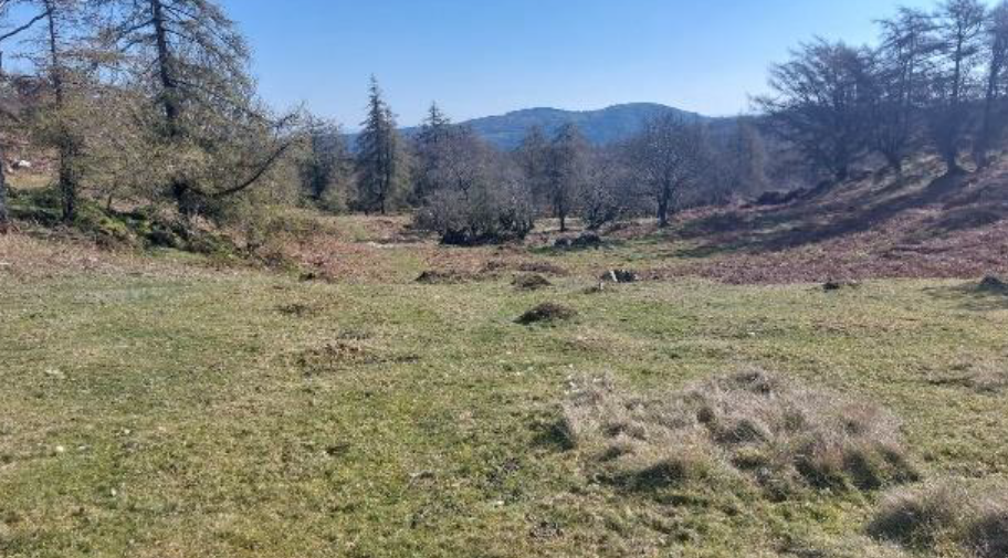
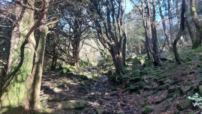
Images below: Area encompassing PROW and potential frequent route of Orienteering Event incorporating control points. No visible trampling, loss of ground vegetation post event; and Internal view of Yewbarrow Woods SAC and SSSI, natural scouring only, no evidence of impacts from the Orienteering Event.
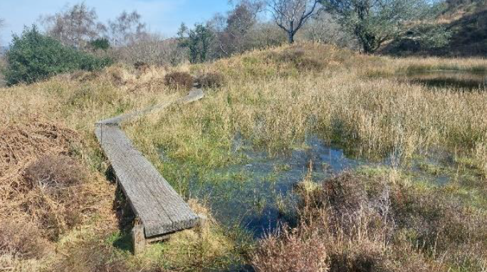
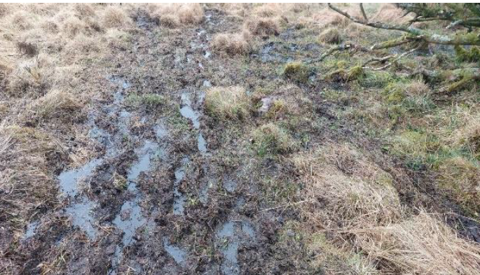
Images above: Second survey visit (14.04.23) post orienteering event. P12 desire line created in low-lying bog; Third survey visit (05.06.24), P12 desire line obscured by bracken, some recovering of ground vegetation.
Recommendations
- Event Planning: It is recommended that where possible, the event is planned during a consistent dry period as the field evidence reflects that trampling is more visible within wet areas. Summer events are would therefore be more appropriate than winter and months of notable higher rainfall. Consideration could also be given to maintaining participating numbers to a given threshold, i.e., no greater than 250 participants.
- Route Planning: The field survey confirmed evidence of trampling within low-lying wet areas purple moor-grass and Sphagnum areas, which did recover post the event. Despite vegetative recovery, Sphagnum communities are sensitive to trampling and will result in the fragmentation and loss of these species and their function in the formation of peat. Future events could therefore consider positioning control points with an aim of diverting foot traffic away from low-lying boggy areas. Whilst this is a potential difficult task, careful design should seek to achieve this where possible.
- Fixed point photography: Due to the scale of the site and extents of the event, it is recommended that fixed point photography locations are established. No more than 15 fixed point locations are recommended, and these should be positioned where there are likely to be high concentrations of foot traffic relative such as around control points. Re-location of fixed-point photography maybe difficult to achieve with handheld GPS, therefore, colored wooden posts with reference numbers written on them should be securely fixed into the ground. The most effective means of establishing fixed point photography will be to arrange a site visit between the appointed ecologist and a member of British Orienteering that has knowledge of future planned events.
- Yewbarrow Wood: Consultation with Natural England resulted in confirmation that recreational activities involving high volumes of people are not desirable within sites of international significance. Whilst there was no evidence of desire lines or trampling within Yewbarrow Wood SAC and SSSI, the potential for negative impacts upon the designation remains a risk for future events. In addition, the event may increase the recreational profile of the site, resulting in other potentially impacting activities such as camping and mountain biking. Natural England identified remote sites such as Yewbarrow Wood to be a rare biodiversity asset and every effort should be explored to safeguard the integrity of such sites. It is therefore recommended that future orienteering events are planned beyond the designation boundaries of Yewbarrow Woods SAC and SSSI.
- Desk Study Data: Communication with Natural England highlighted there was limited information about the wider site in respect of reptiles and ground nesting birds. It was therefore requested that desk study information of the site is sourced prior to any future planned event across the site. It is further recommended that the client allows the Ecology Resources ecologist to submit the record for common lizard to Cumbria Biodiversity Data Centre.
Want to learn more about Access and the Environment? Visit our webpage to discover more about the ongoing work.
Latest News
Chair for Board of Directors